

Three Notched Trail (3NT) Shared-Use Path Master Plan
The Three Notched Trail Shared Use Path planning process is an exciting project that aims to create a multi-purpose trail connecting Charlottesville, Crozet, Albemarle County, and Nelson County. The Three Notched Trail will provide a safe, car-free route for locals and visitors, showcase the region's historic, natural, and agricultural resources, and support the local recreation and tourism economy.
We are working with a multidisciplinary team of planners, engineers, scientists, and civic engagement specialists to develop the Master Plan. The proposed trail will be approximately 24 miles long, and the planning process is estimated to take 24 months. During this timeContinue reading
-
Feedback requested for trail route options
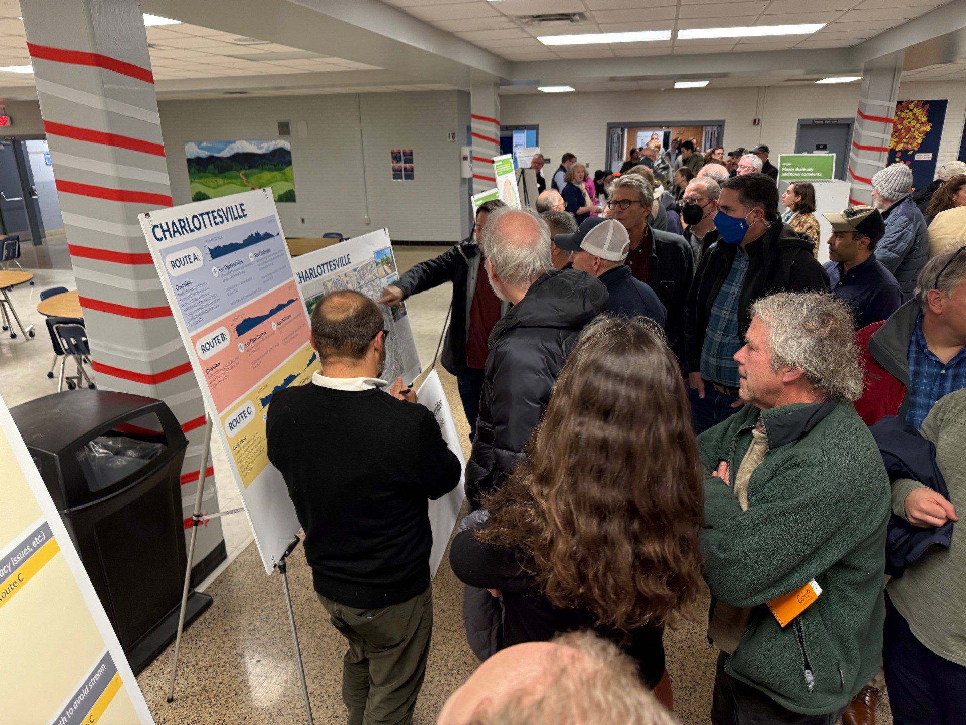
Share Feedback requested for trail route options on Facebook Share Feedback requested for trail route options on X (formerly Twitter) Share Feedback requested for trail route options on Linkedin Email Feedback requested for trail route options linkAlbemarle County is eager to hear public feedback on the various Three Notched Trail's proposed route options. Please visit the project's Virtual Room for the following:
Overall map of the 24-mile corridor, broken into 6 zones
6 individual zone maps
6 zone descriptions
Trail criteria ranking
The survey closes on January 31st.
Thanks to all who attended the Three Notched Trail Public meeting on December 4th! A video of the presentation will be available soon.
-
The summer feedback survey has closed.
Share The summer feedback survey has closed. on Facebook Share The summer feedback survey has closed. on X (formerly Twitter) Share The summer feedback survey has closed. on Linkedin Email The summer feedback survey has closed. link
The Three Notched Trail Master Plan's summer feedback survey has closed. The study team is evaluating the public's responses and is carefully crafting possible trail routes through the corridor. A public meeting will be planned for later this year to show various potential trail routes. Please sign up for the 3NT project email list to be notified of upcoming meetings.
-
Feedback form and mapping tool close August 31 - share your ideas today!
Share Feedback form and mapping tool close August 31 - share your ideas today! on Facebook Share Feedback form and mapping tool close August 31 - share your ideas today! on X (formerly Twitter) Share Feedback form and mapping tool close August 31 - share your ideas today! on Linkedin Email Feedback form and mapping tool close August 31 - share your ideas today! link
On May 15, 2025, Albemarle County hosted a public meeting in Crozet to obtain community feedback on the Three Notched Trail Master Plan. After a brief introduction of the project’s goals, meeting attendees were invited to share feedback at numerous interactive stations.
Recurring feedback included:
- Staying comfortably away from cars is key.
- Attendee’s primary intended trail use is for recreation and exercise.
- Attendees are excited about the “community” that being on the trail will bring.
- Residents are eager to have a very accessible trail, providing opportunities for all ages and abilities.
For those who missed the event but are eager to share feedback, please complete the survey and use the mapping tool by August 31, 2025.
-
Attend the Community Kickoff and Open House on 5/15/25
Share Attend the Community Kickoff and Open House on 5/15/25 on Facebook Share Attend the Community Kickoff and Open House on 5/15/25 on X (formerly Twitter) Share Attend the Community Kickoff and Open House on 5/15/25 on Linkedin Email Attend the Community Kickoff and Open House on 5/15/25 link
 Help Shape the Future of the Three Notched Trail – Join Us May 15!
Albemarle County invites residents and community members to attend the first public meeting for the Three Notched Trail (3NT) Shared Use Path Master Plan on Thursday, May 15, from 6-8 pm at Crozet Elementary, 1407 Crozet Ave, Crozet, VA 22932.
This visionary 24-mile trail will connect Charlottesville to the Blue Ridge Tunnel, providing residents with safer and healthier transportation and recreation options. Over the next two years, the County and its planning partners will identify potential routes, prioritize segments, and build a shared community visionContinue reading

News Sign Up

3NT Study Area


