
FAQs
What would the Three Notched Trail look like?
The trail is proposed as a shared-use path, meaning it will be designed to accommodate people walking, biking, jogging and rolling. It will run from Charlottesville to the Blue Ridge Tunnel in Afton, connecting through Crozet along the way. The trail will permit children in strollers and people using rollerblades, traditional bikes, and e-bikes subject to speed limits. Gas powered bikes and mopeds will not be permitted. Depending on location, the width will be approximately 10’, and the surface will be paved or finely crushed gravel. The trail will have periodic trailheads along the route with parking and restrooms. The trail will be safely separated from vehicle traffic. It will not be lighted, and the hours of use will be from dawn to dusk. To the extent possible, the trail would include gentle curves – both for visual interest and to avoid features like large trees, fences, or landscaped areas. Similar trails in Charlottesville include the Butterfly Greenway near the John Warner Parkway and Schenk’s Greenway along McIntire Road. The Virginia Capital Trail, a 51-mile shared use path connecting Richmond and Jamestown, is a good example of what a long distance trail looks like. 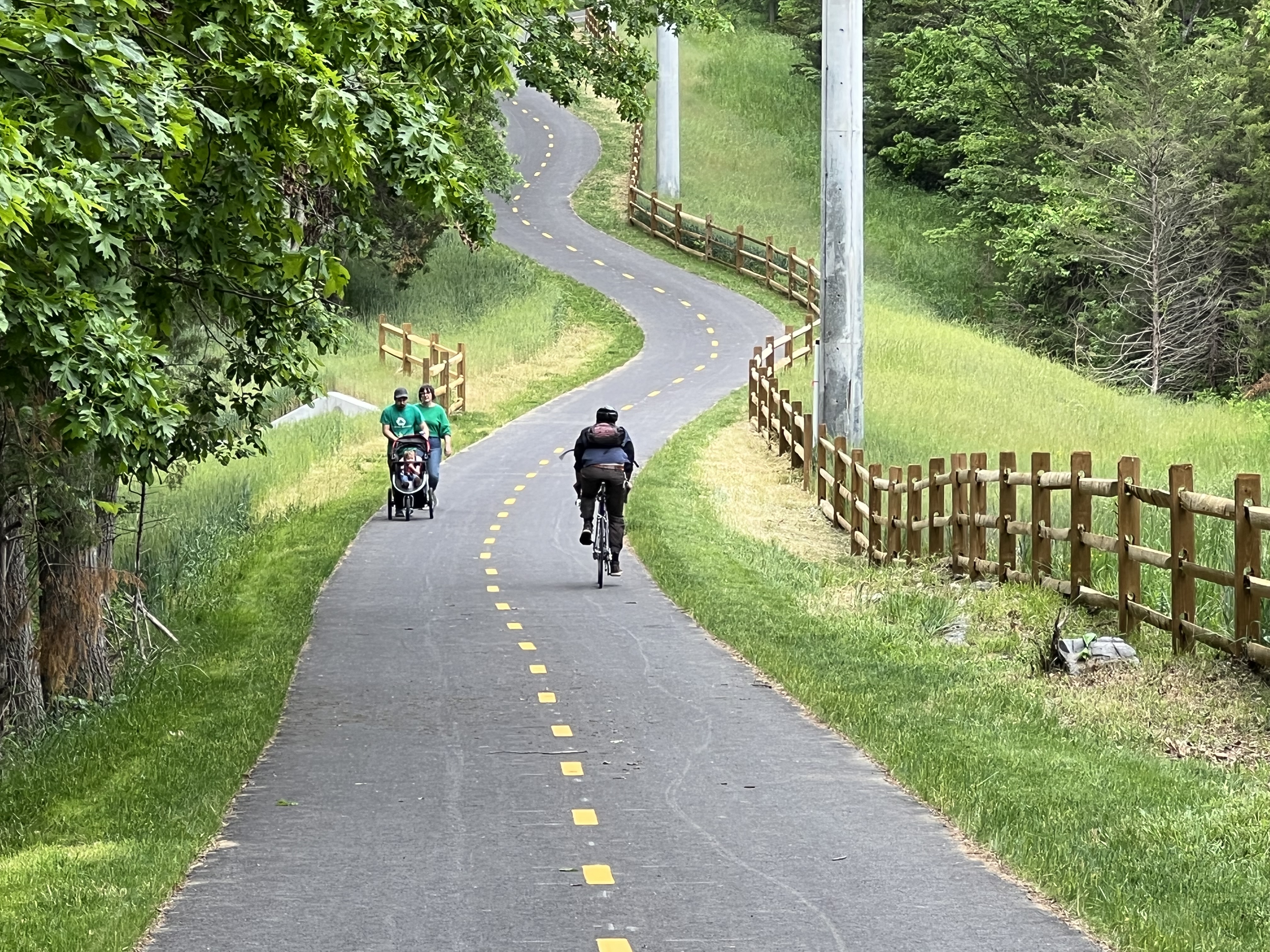
Friendly City Trail, Harrisonburg, VA
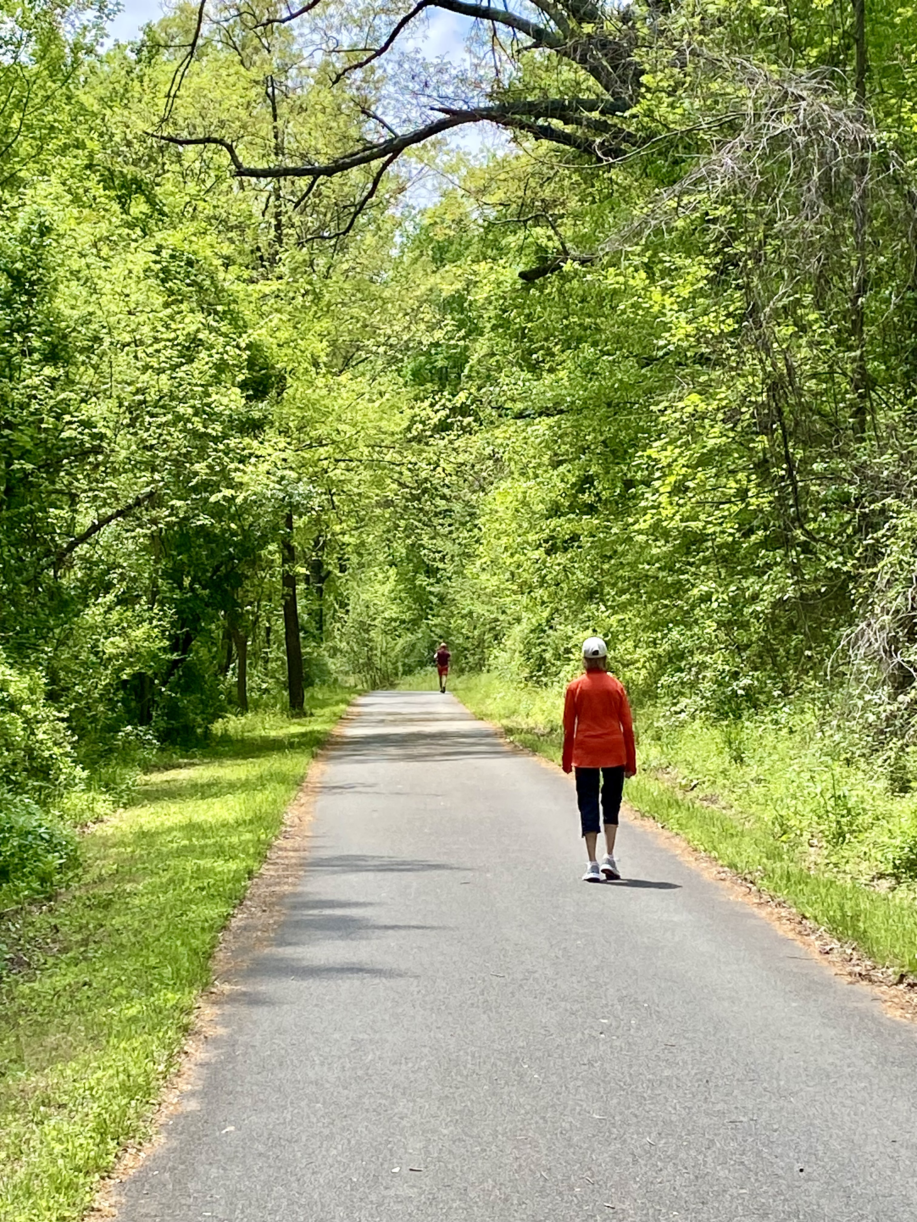
John Warner Parkway Trail, Charlottesville, VA
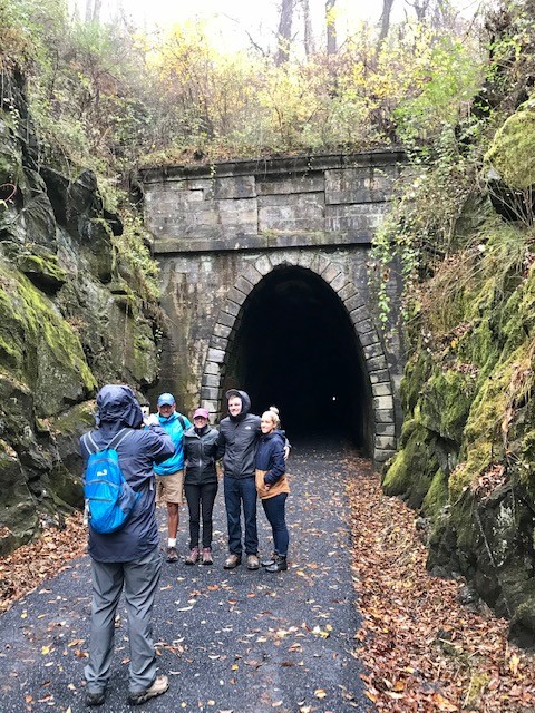
Blue Ridge Tunnel and Trail, Afton, VA
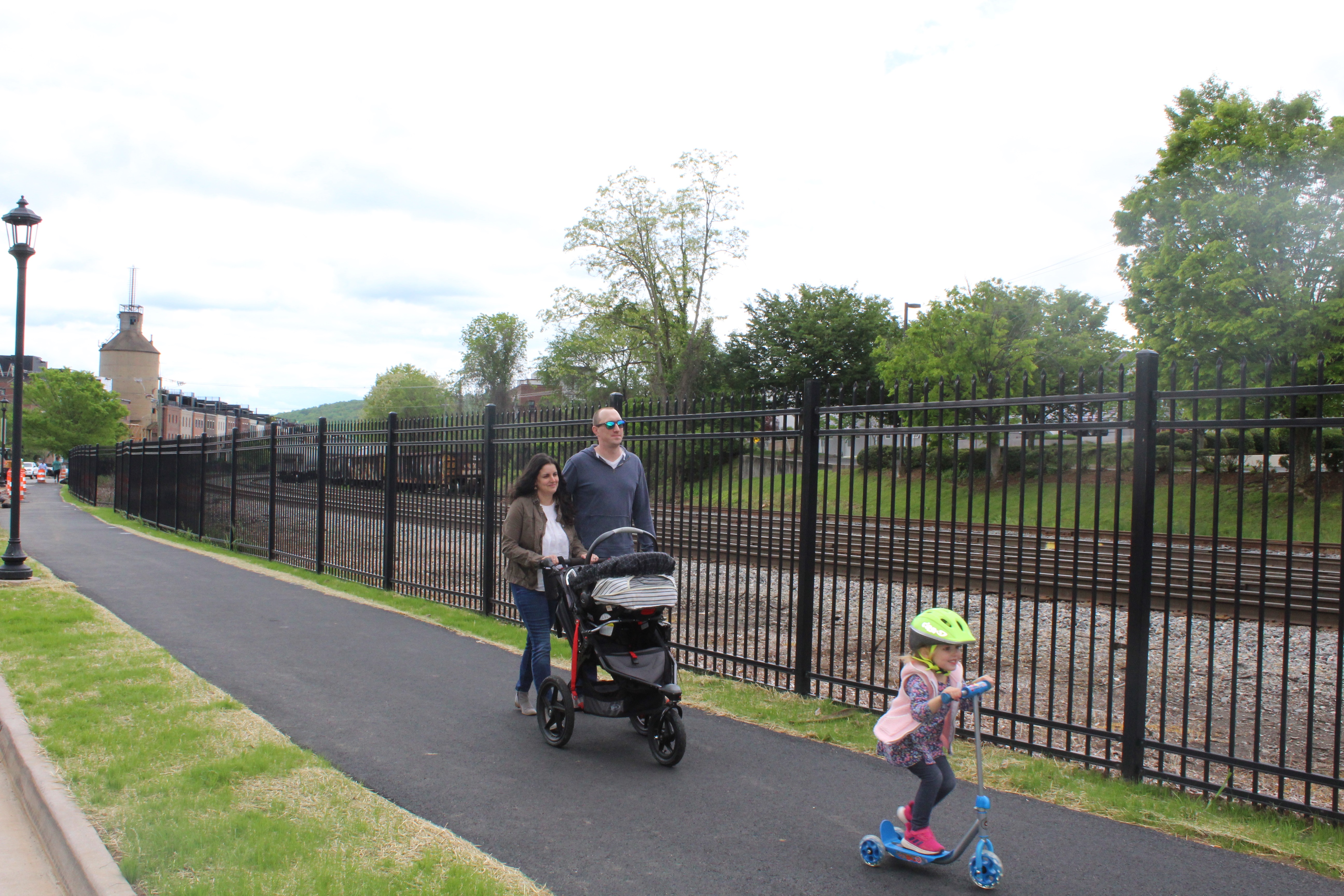
Trail beside railroad on Water St., Charlottesville, VA
What are the benefits to having the trail on my property?
The Three Notched Trail is intended to provide a safe, off-road facility for walking, bicycling, and other non-motorized forms of transportation and recreation. As an adjacent landowner, potential benefits may include direct access to a regional trail network, improved connections to local destinations, expanded recreation and outdoor activity opportunities, and increased transportation options.
Additionally, your private property could benefit from additional project features such as fencing, landscaping, or screening where appropriate, and compensation or tax benefits could be realized. Experience from similar trail projects suggests that trails can provide value to adjacent landowners and support local economic activity, though benefits vary by location.
What is a right-of-way?
A right-of-way is a strip of land reserved for public transportation infrastructure, including a railroad or road itself, shoulders, sidewalks, and drainage. It constitutes a legal easement that allows public entities to construct, operate, and maintain roads and utilities.
Where on my property are you proposing to put the trail?
The planning process to date has identified a generalized preliminary trail route; however, the specific location on your property has not yet been determined and may not be determined for several years. To the extent possible, where the trail is parallel to a roadway or a rail line, the trail will be placed as close to the roadway or rail right-of-way as possible while maintaining safe separation. It is possible that limited right-of-way and/or railroad deed restrictions will require a portion of your property adjacent to the road/rail to be impacted. The exact location of the trail would be determined in consultation with you as more detailed design moves forward.
What is an easement?
A property easement is a legal right that grants an entity the right to use a specific portion of another person’s property for a designated purpose.
What are the options if my property is needed for the trail?
If your property is located along the proposed trail route, there are generally two ways the County may acquire the land needed for the project: a “fee simple purchase” or a “trail easement”. In either case, the County is required to follow a process outlined in federal law (also known as the Uniform Act) and a property valuation will be needed for the County to make a reasonable offer that is considered fair compensation. Additionally, a title search of each parcel will be needed to be aware of any additional easements or encumbrances on the property. More information about each option is described in this table.

Which option is right for me, fee simple versus easement?
There is no one-size-fits-all approach. Some landowners prefer a fee simple purchase if they no longer wish to own or maintain the land needed for the trail. Others prefer an easement because it allows them to retain ownership while supporting the trail project. If your property is identified as part of the proposed trail route, the project team will work with you to discuss available options, answer your questions, and determine the approach that best meets your needs while helping create a safe, connected trail for the community.
What impact would the trail have on my property taxes?
The impact on property taxes depends on how the land needed for the trail is acquired and how the property is assessed by the local tax authority. Please see the chart connected to question, "What are the options if my property is needed for the trail?"
How would the trail affect my property values?
The effect of a trail on property values varies from property to property and depends on factors such as location, property type, trail design, access points, and surrounding land uses. In most cases where similar trails have been developed, they have had a positive impact on property value when a property is sold. In a 2020 survey of prospective homebuyers, 76% of respondents said living in a walkable community was somewhat or very important in deciding where to live. Case studies, such as one on the impact of the Little Miami Scenic Trail, have been done to show that trail access is a marketable feature that increases property resale value. Not only is proximity to a trail desirable to buyers, trails also aid property values by reinvigorating the local economy by increasing visibility and accessibility of local businesses, which provides additional benefits to property values.
What is my liability from allowing the trail on my property?
Virginia Code § 15.2-1809.1, provides liability protections to localities and landowners that lease or provide an easement to a locality for recreational public use (hiking, biking, walking etc.) from injuries that occur on such trails, absent any gross negligence or willful misconduct.
What screening options are available for privacy?
The County will discuss with individual owners the need for landscaping, fencing, or other screening to be installed as part of trail construction. Even if your home is visible from the trail, this can be ameliorated with foliage and fencing, and property owners on other trails have not reported this as an issue. For further information, review the “Impact of the MKT Trail on Nearby Landowners” for a comprehensive study of landowners’ concerns as compared to their ultimate experience of having a trail on their land.
If I allow the trail on my property, who will maintain it?
Trail maintenance would be the responsibility of the County and/or partner governmental or non-profit agencies. Individual property owners will not be responsible for trail maintenance.
I have a conservation easement on my land. Does that prevent me from allowing this trail to be built?
The terms of the conservation easement would need to be reviewed to determine what restrictions, if any, would apply to a trail easement on the property, and whether the easement holder would need to be a signatory for any conveyance of a trail/recreational easement.
(Applies to trail adjacent to a railroad) Why can’t the trail be placed exclusively on the railroad’s property and not on my property?
The railroad right-of-way includes a deed restriction prohibiting trail use. The County has coordinated with the railroad on needed rail crossings and potential right-of-way use, and will continue conversations with the railroad as detailed design progresses to minimize private property impacts to the extent practical. In addition to deed restrictions, there are significant physical constraints adjacent to the rail road, including steep topography.
(Applies to trail adjacent to a public roadway) My property borders a roadway and the trail is proposed to follow that roadway. How does this affect my property?
To the extent possible, trail alignments along roadways are intended to be separated from the roadway but within the road’s right-of-way. In some cases, the available right-of-way is not wide enough to accommodate the full trail width and so additional right-of-way or easement space may be needed from landowners.