
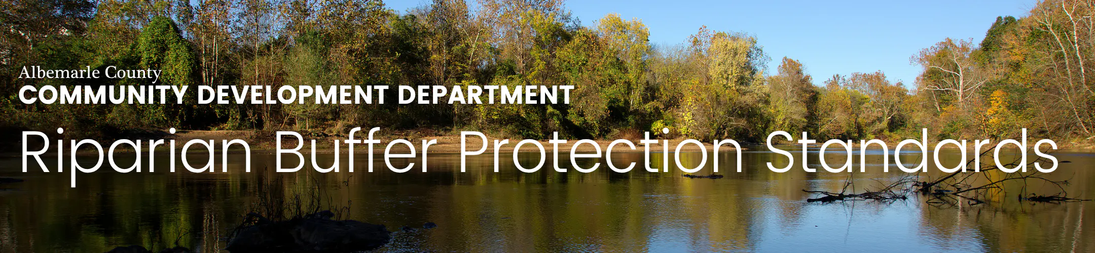
Riparian Buffer Protection Standards
Albemarle County is developing Riparian Buffer Protection Standards to protect and improve vegetation along rivers and streams, strengthen buffer requirements that were narrowed in 2014, and ensure consistency with Virginia's Chesapeake Bay Preservation Act. This project is an outcome of the Stream Health Initiative, a program designed to improve surface water quality, established by the Board of Supervisors in 2017.
If adopted, the protection standards would:
- set requirements for retaining and protecting riparian vegetation and limiting land disturbance in buffers throughout the county
- protect and enhance all of the defined buffers, whether they’re part of a development projectContinue reading
Albemarle County is developing Riparian Buffer Protection Standards to protect and improve vegetation along rivers and streams, strengthen buffer requirements that were narrowed in 2014, and ensure consistency with Virginia's Chesapeake Bay Preservation Act. This project is an outcome of the Stream Health Initiative, a program designed to improve surface water quality, established by the Board of Supervisors in 2017.
If adopted, the protection standards would:
- set requirements for retaining and protecting riparian vegetation and limiting land disturbance in buffers throughout the county
- protect and enhance all of the defined buffers, whether they’re part of a development project or not
Please note that these protection standards do not apply to agriculture and forestry.
Why is it important?
Riparian buffer vegetation is significant to stream health since it protects streams from erosion and filters out nutrients and sediment that can flow into streams and degrade water quality. This benefits both our community’s public water supply and aquatic habitats. Community benefits would include better water quality, fewer expenses for clearing out reservoirs affected by sedimentation, and healthier wildlife populations.
The County's current stream buffer regulations are housed in the Water Protection Ordinance (WPO) and only apply to land-disturbance projects that require erosion and sediment control plans(e.g., commercial and residential development projects). This means that a lot of activity that impacts stream buffers isn't currently regulated -- and that adds up. In short, the WPO buffer requirements only regulate specific larger projects. In contrast, the Riparian Buffer Protection Standards would regulate and protect all stream buffers in the county (except those used for agriculture and forestry).
While the proposed stream buffer regulations would be located in the Zoning Ordinance, this proposed draft also contains changes to the Water Protection Ordinance (to remove the current buffer requirements), and to make language related to buffers more consistent in the Subdivision Ordinance (chapter 14 of the County Code) and the Health and Safety ordinance (chapter 7).
-
Riparian Buffer Protection Standards adopted on 6/17/26
Share Riparian Buffer Protection Standards adopted on 6/17/26 on Facebook Share Riparian Buffer Protection Standards adopted on 6/17/26 on X (formerly Twitter) Share Riparian Buffer Protection Standards adopted on 6/17/26 on Linkedin Email Riparian Buffer Protection Standards adopted on 6/17/26 linkConsultation has concluded. The Riparian Buffer Protection Standards were adopted on 6/17/26. Thanks to everyone who participated!
Consultation has concluded. The Riparian Buffer Protection Standards were adopted on 6/17/26. Thanks to everyone who participated!
-
Project Update: May 2026
Share Project Update: May 2026 on Facebook Share Project Update: May 2026 on X (formerly Twitter) Share Project Update: May 2026 on Linkedin Email Project Update: May 2026 linkBoard of Supervisors Public Hearing Scheduled for 6/17/26
What will be considered at the public hearing?
At the hearing, the Board of Supervisors will receive a presentation from staff, hear public comment, and consider adopting the proposed amendments.
The draft ordinance addresses permitted uses and activities within riparian buffers, as well as related procedures. As proposed, buffer locations will remain the same as those in the current Water Protection Ordinance, but performance standards will be set in the Zoning Ordinance. Agricultural and silvicultural uses would still be exempted from the ordinance requirements.
Board of Supervisors Public Hearing Scheduled for 6/17/26
What will be considered at the public hearing?
At the hearing, the Board of Supervisors will receive a presentation from staff, hear public comment, and consider adopting the proposed amendments.
The draft ordinance addresses permitted uses and activities within riparian buffers, as well as related procedures. As proposed, buffer locations will remain the same as those in the current Water Protection Ordinance, but performance standards will be set in the Zoning Ordinance. Agricultural and silvicultural uses would still be exempted from the ordinance requirements.
Why is Albemarle County proposing an update to riparian buffer protections?
This proposal comes from the County’s Stream Health Initiative, which aims to improve water quality. The Board of Supervisors began this ordinance amendment process in 2022, following the Stream Health Initiative’s 2021 recommendations.
Why is this important?
Healthy riparian buffers protect drinking water, reduce flood impacts, support wildlife, and improve stream health. Current rules only apply when land disturbance is 10,000 square feet or more, leaving smaller projects unregulated. The new rules would apply to all vegetation changes in these buffer areas, whether or not there's a development project.
What are the community benefits?
- Enhanced protections for water quality and stream health
- Enhanced floodplain and wildlife habitat protection
- Helps meet goals in the County’s Comprehensive Plan
Key updates in the proposal
- Move riparian buffer rules from the Water Protection Ordinance to the Zoning Ordinance
- Keep the buffer boundaries the same as before
- Create clear standards for managing vegetation in buffers
-
List what activities are allowed in buffers:
- Allowed by right: farming, forestry, utilities, water-related facilities, passive recreation, historic preservation, and planting native vegetation
- Allowed with approval: certain uses that require a mitigation plan
- Require site-specific buffer boundary determinations by professionals
- Establish the role of a Riparian Buffer Administrator to enforce rules
- Provide a process for special exceptions
- Update the County’s Design Standards Manual for guidance on planting and vegetation management
*Note: The ordinance amendments for the Riparian Buffer Protection Standards include changes to four separate chapters of the County Code. The bulk of the new additions (to support the new buffer standards) are in the proposed Zoning Ordinance. The draft Water Protection Ordinance includes the deletion of the old stream-buffer standards, which are being replaced, as well as housekeeping changes. The Health and Safety and Subdivision chapters are being amended to update terminology ("riparian buffer" rather than "stream buffer") and to refer to the updated regulations.
-
Planning Commission Public Hearing Scheduled for 1/27/26
Share Planning Commission Public Hearing Scheduled for 1/27/26 on Facebook Share Planning Commission Public Hearing Scheduled for 1/27/26 on X (formerly Twitter) Share Planning Commission Public Hearing Scheduled for 1/27/26 on Linkedin Email Planning Commission Public Hearing Scheduled for 1/27/26 linkUpcoming Planning Commission Public Hearing
At this hearing, the Planning Commission will hear public comment and make a recommendation to the Board of Supervisors regarding these proposed amendments. The proposed buffer locations remain the same as those contained in the current Water Protection Ordinance, but the performance standards would be contained in the Zoning Ordinance. Agricultural and silvicultural uses would still be exempted from the ordinance requirements. The draft ordinance, provided for this public hearing, addresses permitted uses and activities in riparian buffers and related procedures.
What is being proposed?
Albemarle County wants to update its rules for protecting riparianContinue reading
Upcoming Planning Commission Public Hearing
At this hearing, the Planning Commission will hear public comment and make a recommendation to the Board of Supervisors regarding these proposed amendments. The proposed buffer locations remain the same as those contained in the current Water Protection Ordinance, but the performance standards would be contained in the Zoning Ordinance. Agricultural and silvicultural uses would still be exempted from the ordinance requirements. The draft ordinance, provided for this public hearing, addresses permitted uses and activities in riparian buffers and related procedures.
What is being proposed?
Albemarle County wants to update its rules for protecting riparian buffers—areas of natural vegetation next to streams, wetlands, ponds, and reservoirs. These buffers help keep water clean by filtering runoff and reducing pollution.
Why is this important?
Healthy riparian buffers protect drinking water, prevent flooding, support wildlife, and improve stream health. Current rules only apply when land disturbance is 10,000 square feet or more, leaving smaller projects unregulated. The new rules would apply to all vegetation changes in these buffer areas, whether or not there's a development project.
Key changes in the proposal:
- Move riparian buffer rules from the Water Protection Ordinance to the Zoning Ordinance.
- Keep the buffer boundaries the same as before.
- Create clear standards for managing vegetation in buffers.
- List what activities are allowed in buffers:
- Allowed by right: farming, forestry, utilities, water-related facilities, passive recreation, historic preservation, and planting native vegetation.
- Allowed with approval: certain uses that require a mitigation plan.
- Require site-specific buffer boundary determinations by professionals.
- Establish the role of a Riparian Buffer Administrator to enforce rules.
- Provide a process for special exceptions.
- Update the County’s Design Standards Manual for guidance on planting and vegetation management.
Background:
This proposal comes from the County’s Stream Health Initiative, which aims to improve water quality. The Board of Supervisors started this process in 2022 after adopting recommendations in 2021.
Benefits:
- Protects water quality and stream health.
- Helps meet goals in the County’s Comprehensive Plan.
- Supports floodplain protection and wildlife habitat.
-
Board of Supervisors Work Session Scheduled for 8/20/25
Share Board of Supervisors Work Session Scheduled for 8/20/25 on Facebook Share Board of Supervisors Work Session Scheduled for 8/20/25 on X (formerly Twitter) Share Board of Supervisors Work Session Scheduled for 8/20/25 on Linkedin Email Board of Supervisors Work Session Scheduled for 8/20/25 linkUpcoming Board of Supervisors Work Session
The riparian-buffer ordinance updates are scheduled for a work session with the Board of Supervisors on August 20, 2025. The project has been re-named Riparian Buffer Protection Standards, to reflect a shift in approach from an overlay zoning district to performance-standards legislation. The proposed buffer locations remain the same as those contained in the current Water Protection Ordinance, but the performance standards would be contained in the Zoning Ordinance. The latest proposed ordinance amendments will be available upon release of the agenda for the August 20 meeting.
Upcoming Board of Supervisors Work Session
The riparian-buffer ordinance updates are scheduled for a work session with the Board of Supervisors on August 20, 2025. The project has been re-named Riparian Buffer Protection Standards, to reflect a shift in approach from an overlay zoning district to performance-standards legislation. The proposed buffer locations remain the same as those contained in the current Water Protection Ordinance, but the performance standards would be contained in the Zoning Ordinance. The latest proposed ordinance amendments will be available upon release of the agenda for the August 20 meeting.
Key Dates
-
June 17 2026
-
January 27 2025
-
August 20 2025


Who's Listening
Terms to Know
Riparian Buffer: A riparian buffer is an area adjacent to a stream, lake, or wetland that contains a combination of trees, shrubs, and/or other perennial plants and is managed differently from the surrounding landscape, primarily to provide conservation benefits. Learn more.
Water Quality: Refers to the condition or characteristics of water that determine its suitability for various purposes and its impact on the environment and living organisms. It involves assessing the chemical, physical, biological, and microbiological properties of water to determine its overall health and safety. Factors such as the presence of pollutants, levels of dissolved oxygen, pH balance, clarity, and the absence of harmful bacteria or contaminants all contribute to the assessment of water quality. Monitoring and maintaining good water quality is important for the health of ecosystems, human consumption, agriculture, and recreational activities.
Water Protection Ordinance (WPO): A chapter of the County Code that was added in 1988 to protect water quality from erosion, stormwater pollution, etc. The County wanted to both protect local water quality and take part in the wider efforts to restore the Chesapeake Bay. Most of its provisions are enforced by the Engineering Division of our Community Development Department.